Discover the Power of Professional Drone Imaging
- Jan 26
- 3 min read
Imagine capturing breathtaking aerial views that transform your project’s story. That’s the power of professional drone imaging. Whether you’re showcasing a property, monitoring construction progress, or creating unforgettable wedding memories, drones elevate your perspective. I’m excited to share how this technology can revolutionize your work and bring your vision to life.
Why Choose Professional Drone Imaging?
Professional drone imaging is more than just flying a camera in the sky. It’s about precision, creativity, and delivering results that matter. When you work with experts, you get:
High-quality visuals: Crisp, clear images and videos that highlight every detail.
Safety and compliance: Licensed pilots who follow all regulations, keeping your project risk-free.
Customized solutions: Tailored services that fit your unique needs and goals.
For example, real estate agents can showcase properties with stunning aerial shots that attract more buyers. Construction companies can track progress and identify issues early, saving time and money. Couples can capture their special day from angles no traditional photographer can reach.

How Professional Drone Imaging Transforms Industries
The impact of professional drone imaging spans many fields. Let’s explore some key industries and how they benefit:
Real Estate
Imagine listing a home with sweeping aerial views of the neighborhood, nearby parks, and the property’s unique features. Buyers get a complete picture before stepping inside. This immersive experience increases interest and speeds up sales.
Construction
Tracking a project’s progress from the sky helps managers spot delays, safety hazards, and quality issues early. Drones provide detailed site maps and 3D models, improving planning and communication with stakeholders.
Events and Weddings
Capture your event from angles that tell a story. Aerial shots add drama and emotion, making your memories unforgettable. Drone footage can highlight the venue, guests, and special moments in a way ground photography cannot.
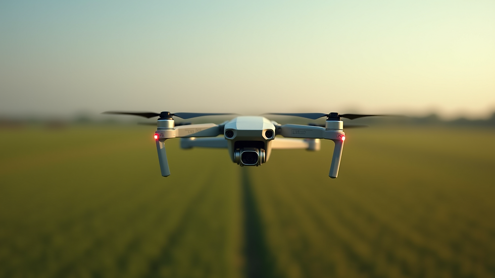
Agriculture
Farmers use drones to monitor crop health, irrigation, and pest control. This data-driven approach boosts yields and reduces costs by targeting resources where they’re needed most.
Unlocking the Potential of Aerial Data
Professional drone imaging isn’t just about pretty pictures. It’s about actionable insights. Drones collect data that helps you make smarter decisions.
Mapping and surveying: Create accurate maps and 3D models quickly and affordably.
Inspection: Check roofs, towers, and infrastructure without risking human safety.
Environmental monitoring: Track changes in landscapes, water levels, and wildlife habitats.
For instance, a construction company can use drone data to compare planned designs with actual progress, ensuring projects stay on track. This level of detail was once impossible without expensive equipment and time-consuming methods.
How to Get Started with Professional Drone Imaging
Ready to harness the power of drone technology? Here’s how to begin:
Identify your goals: What do you want to achieve? Better marketing photos, site inspections, or event coverage?
Choose the right provider: Look for licensed professionals with experience in your industry.
Plan your project: Discuss timelines, locations, and specific shots or data you need.
Review and use the results: Use the images and data to enhance your marketing, improve operations, or preserve memories.
By partnering with a trusted drone service provider, you ensure smooth operations and outstanding results. For example, drone services like those offered by Drone Discovery in Connecticut combine expertise with cutting-edge technology to deliver exactly what you need.
Elevate Your Projects with Drone Discovery
Drone Discovery aims to be the leading professional drone service provider in Connecticut. Their mission is to help businesses and individuals transform projects with stunning aerial visuals and critical data. Whether you’re in real estate, construction, agriculture, or planning a special event, they bring unmatched skill and passion to every flight.
Imagine the possibilities when you add professional drone imaging to your toolkit. You’ll gain new perspectives, save time, and impress clients with visuals that stand out. Don’t settle for ordinary when you can soar above the rest.
Take the leap and discover how drone technology can elevate your work today.
Ready to see your project from a new angle? Professional drone imaging is waiting to take you there.


Comments